Surely, there are many bike routes to go through the city.
I wonder if I can make it on my bike all the way around Brooklyn.
First, I have to cross Roosevelt Island Bridge to Queens.
Where a bike path takes me under the Queensboro Bridge going south to the Pulaski Bridge that links Queens with Brooklyn.
It takes about 15 minutes doing a leisurely ride from Roosevelt Island to Brooklyn.
And here we are going up on the Pulaski Bridge.
The Pulaski Bridge sports two dedicated bike lanes and a view of Queens and the magnificent Manhattan skyline any time of day or night!
And we are already in Brooklyn!
I am going in the South-East direction toward Howard Beach.
I navigate through the city following bike lanes as much as possible.
It took me about one hour to reach the Belt Parkway and Cross Bay Boulevard.
That is where I steer on a bike path going west along the shore.
Passing by Spring Creek Park, then Shirley Chisholm State Park.
Riding this bike path is a relief after an hour riding through city traffic ;)
It is a nice dedicated bike path.
The next is Canarsie Pier.
The path goes mile after mile...nice.
A panoramic view from the bridge.
An intersection with Flatbush Avenue.
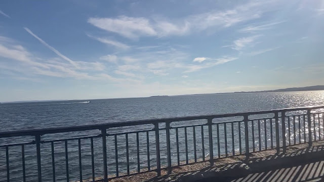
From here, I can see Rockaway Beach.
Another panoramic view of the city and...I think it is the Verrazano Bridge!
OK. Let's move on.
Next is Plumb Beach - my favorite beach in New York.
And we are back to city traffic on Emmons Avenue.
Heading west along the Belt Parkway.
Staying on a bike path helps to navigate through the city.
The Verrazano Bridge is right ahead!
The bike path, the view, the feeling of space...
It's all so wonderful!
Take a look around.
At this point, I am about 2/3 of the way through my lap around Brooklyn.
The view is so good - I have to stop here to take photos.
It would be nice to bike across the Verrazano Bridge.
There is no bike lane on the bridge, yet...
Well, the bike path goes along the shore now in the north direction.
Turn on Bay Ridge Ave brings me back into city traffic.
I see wind power stations here.
Heavy traffic...I want out of here!
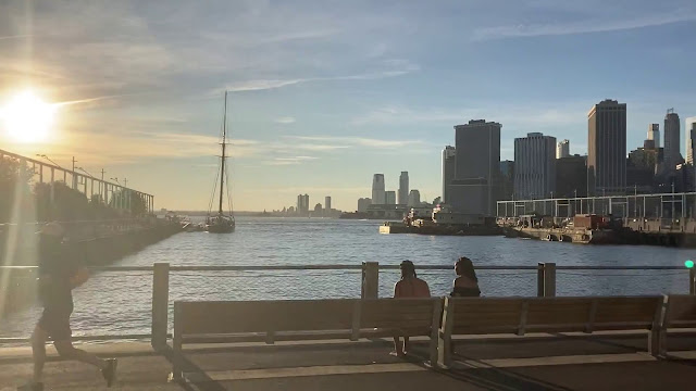
Yes! I am on the waterfront bike path at Brooklyn bridge park.
It is one of the best parks in New York with a view of Manhattan that should make residents of Manhattan jealous ;)
Here it comes.
Check it out!
The view from a terrace up there is even better.
The bike path brings us right under the Brooklyn Bridge.
My kids’ favorite Brooklyn Ice Cream Factory used to be in this building.
Here I am standing between the Brooklyn and Manhattan Bridges.
Panoramic view here!
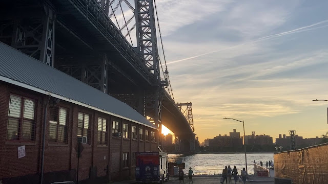
The bike path takes us from here around Brooklyn Navy Yard to the Williamsburg Bridge.
Here is the Williamsburg Bridge at sunset.
I am navigating through the streets of Green Point to the Pulaski Bridge.
The Pulaski Bridge is the start and the end point of this lap around Brooklyn.
Up the bridge to the finish line!
Congratulations! The mission is accomplished!
I made about 45 miles long lap around Brooklyn in under 4.5 hours on my Boardwalk single speed 20 inch wheel bike.
Feels great!
Check the links in the description for more details on my Strava app about this and my other rides.
In the meantime, I still have to ride back to Roosevelt Island ;)
Under the Queensboro bridge heading North.
Up across the Roosevelt Island bridge.
And down the spiral ramp I am going.
Home run :)
Have fun and happy rides :)


No comments:
Post a Comment